Images are scanned & saved as RGB True Color 24-bit, 150 PPI, JPEG compressed, & look OK on a monitor with graphics adapter capable of 24-bit color, or high-color 16/15-bit, and a screen resolution setting of 640x480 or 800x600 pixels.
Tips for viewing large images: Use a screen resolution setting of 800x600 pixels. In Netscape turn off the toolbars. In Microsoft Internet Explorer (v4.0) use the Full Screen mode (in View menu or F11 key). In MS Windows minimize or hide the Taskbar.
Use your browser's [Back] button to return to this page from an image (or Back under the Go menu in Netscape if the Navigation toolbar is turned off, Alt+Left arrow key also works). Or, right click on an image link & open the link in a new browser window, then close the window after viewing.
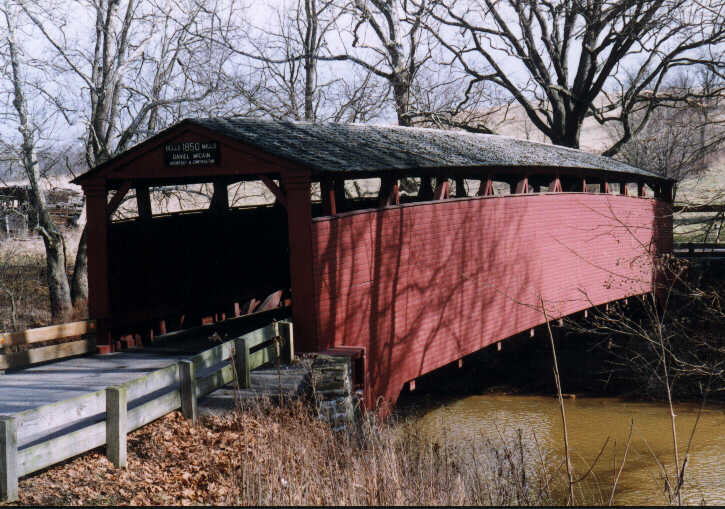
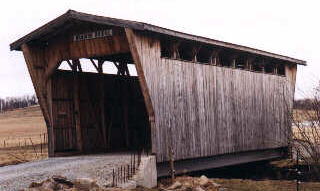
Bells Mills Covered Bridge (1850), the only covered bridge left in Westmoreland County (aside from a few small private bridges built in more recent time). Spans Sewickley Creek near Yukon & Lower Whyel on SR3012, just east of Rt136 northeast of West Newton. The bridge is 95 feet long & 14 feet wide, open to vehicular traffic with a weight & height restriction. Photo February 2 1998.
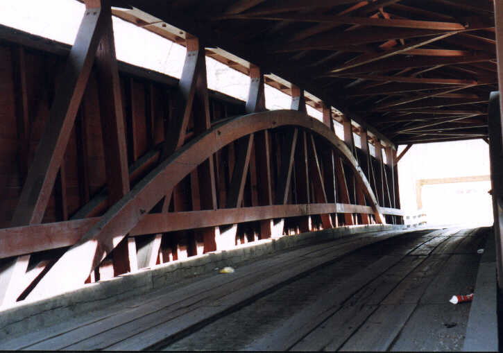
Bells Mills Covered Bridge, interior framework.
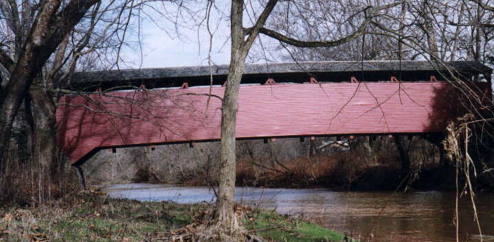
Bells Mills Covered Bridge, side view from downcreek.
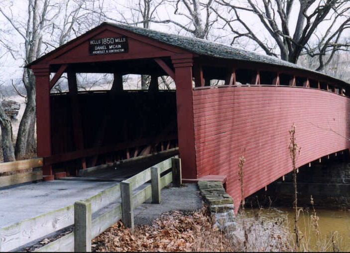
Bells Mills Covered Bridge
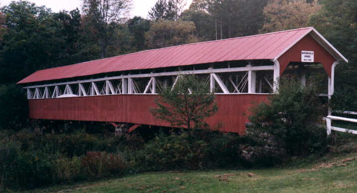
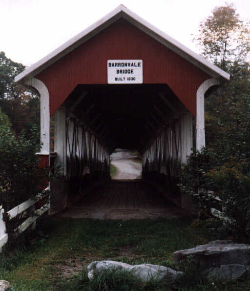
Barronvale Covered Bridge (1830) in Somerset County, south of Laurel Hill State Park (Trent). Notice the pier supporting the center of the span. Bridge is closed to vehicular traffic. The bridge plate says 1830, but other sources put the date at 1846, 1902. Photo September 30 1998.
Barronvale Covered Bridge
Bradish Covered Bridge, a recently built private bridge in Westmoreland County.
Naugle Covered Bridge in Rolling Rock, Ligonier. A replica of a covered bridge originally in Somerset County.
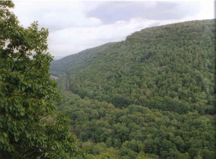
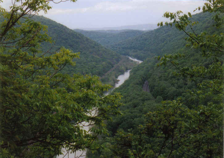
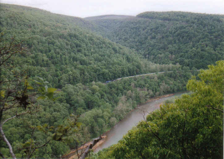
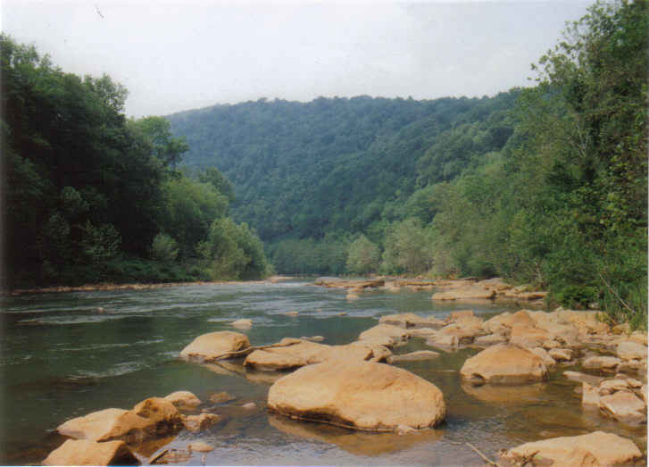
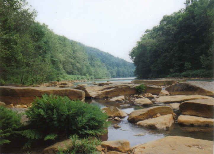
Packsaddle Gap, where the Conemaugh River cuts through Chestnut Ridge between Torrance and Bolivar, Wesmoreland County; between Blairsville and Robinson, Indiana County. The gorge is just over 1,300 feet deep with steep sides, about 3 miles long, 0.5 to 1.0 mile wide at the top. Photos taken May 2005.
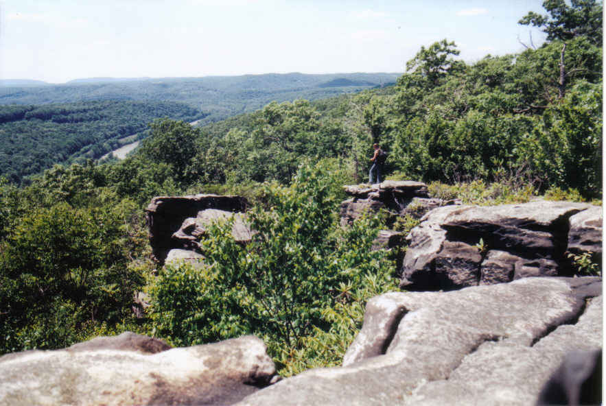
Oaks Point Overlook, looking east
Looking east (upriver) along much of the length of the gorge. A high point of land on the right, Westmoreland County, is 2288 feet elevation. A high point of land on the left, the highest point in Indiana County, is 2160+ feet elevation. The 980 ft topo map contour line crosses the river in the upriver (eastern) portion of the gorge. Oaks Point Overlook is at the 1600 ft elevation topo map contour line.
looking west toward Torrance, w/train passing thru.
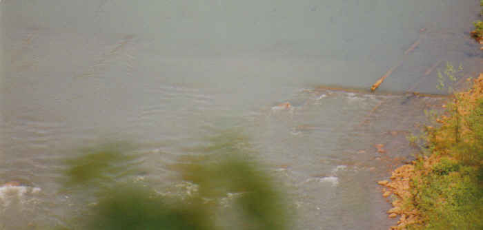
Remnants of slackwater dam, photo taken from an Oaks Point overlook.
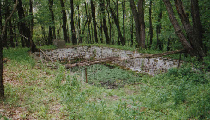
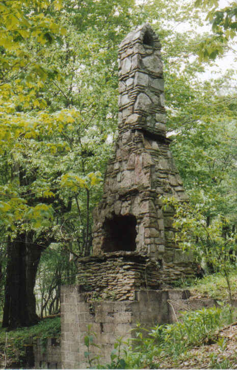
Remnants of Oaks Point Boy Scout Camp/Resort, Packsaddle Gap, outside Strangford, May 2005: Cistern | Pool | Fireplace
Photos June 2005:
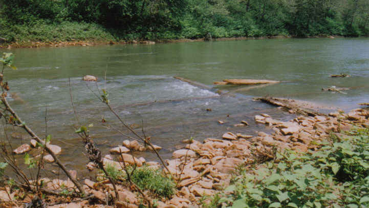
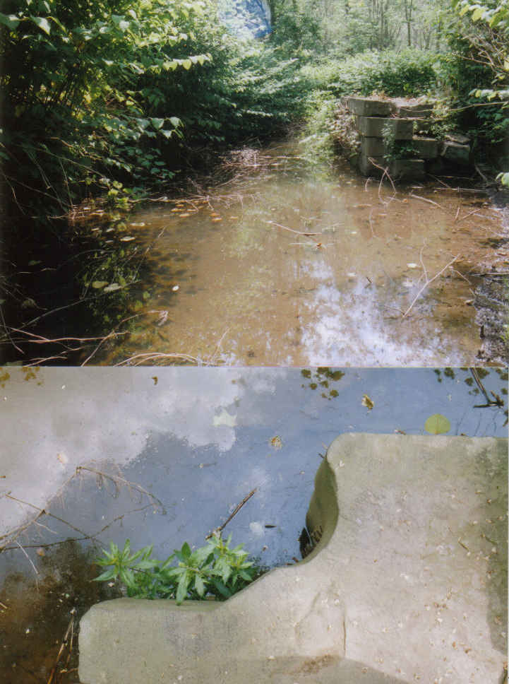
Remnants of a slackwater dam (PA Canal circa mid 1800s) in Packsaddle Gap, photo taken at river level. The water was up a little and murky from rain the day before, so detail further in river can't be seen.
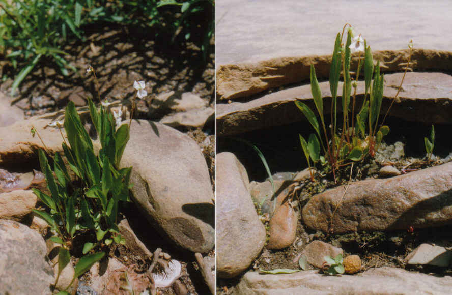
Lance-leaved violets are on the shoreline at the slackwater dam remnants.
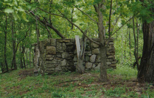
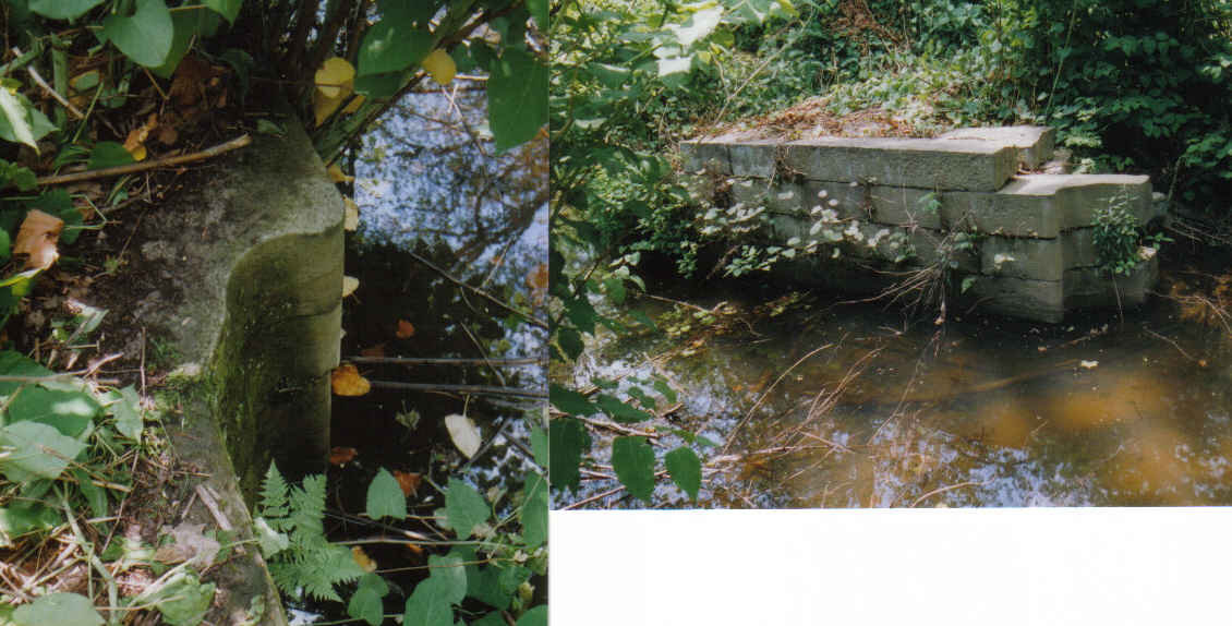
Lock #5, semi well preserved, is hidden in Packsaddle Gap. No easy way of getting to it. The wooden heel post of the lock gate sat into the curved stone work. Photo on right shows north wall of lock, which is less complete then the south wall. Much of the gate recess is missing.
Upper photo shows Japanese Knotweed covering much of the lock, especially the south (left) side where there is a recess into which a lock gate was received. Lower photo shows curved stone work for lock gate heel post; Lock #5.
Photos of the eastern end of Packsaddle Gap
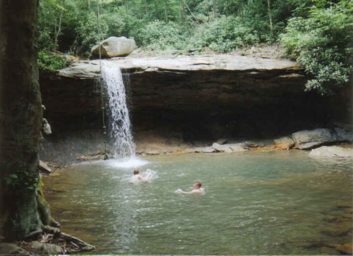
Falls on Roaring Run, a swimming hole outside Robinson; Falls | Falls
Royal Fern
Looking west into the gap, hill in distance is highest point in Indiana County.
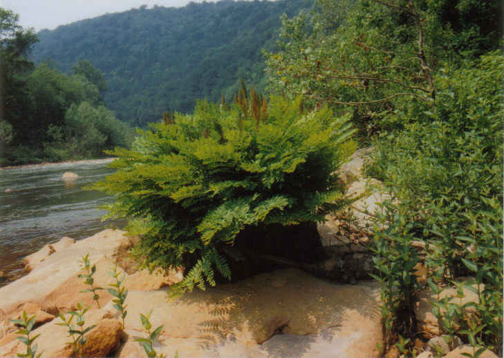
Rock strewn area of river below the mouth of Roaring Run, large clump of Royal Fern in foreground.
Overlook from Clark Run Trail in the Charles F. Lewis Natural Area, west of Johnstown, June 2004.
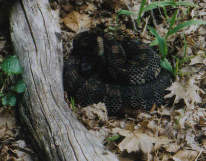
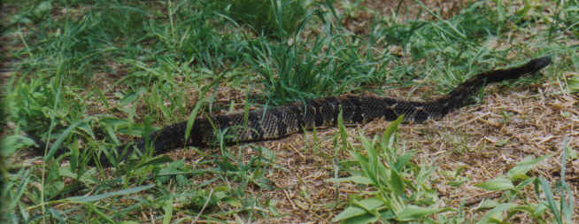
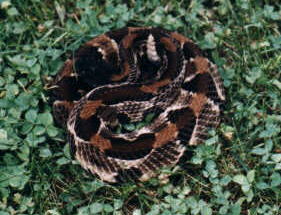
Timber Rattlesnake, May 2005 warning & poised to strike (in self defense) | moving to cover | back to protection of cover | on the move.
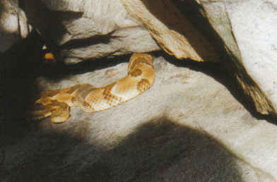
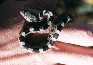
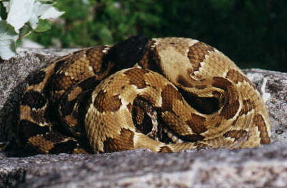
A different day at another location Yellow phase, Timber Rattlesnake.
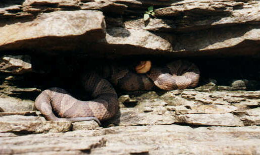
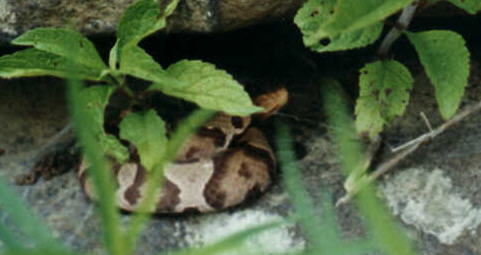
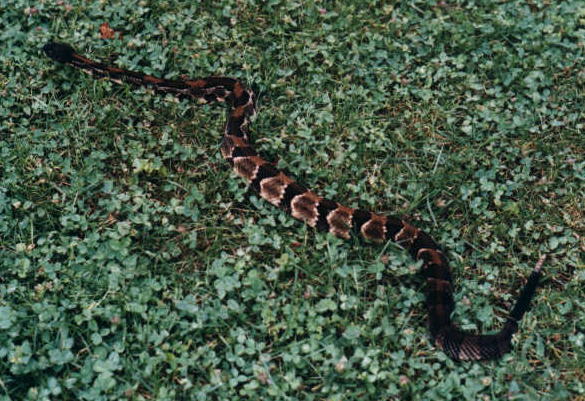
Copperhead @ Loyalhanna Lake, August 1996. (In the image the shadow area is too dark, I did not use a fill flash when the photo was taken.)
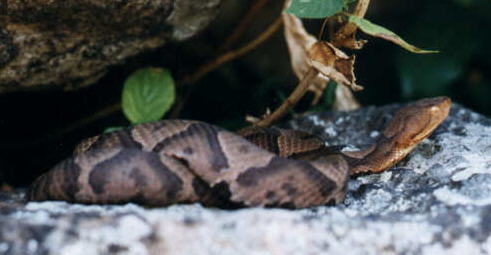
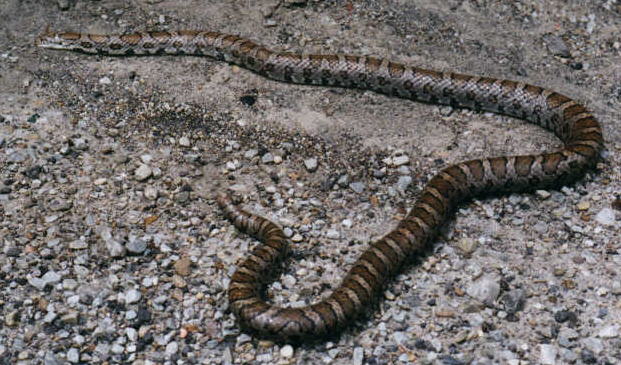
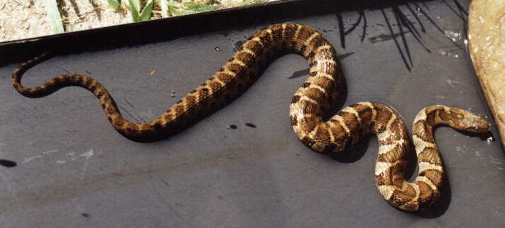
Copperhead @ Ohiopyle August 8 1997.
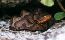
Copperhead @ Ohiopyle August 14 1997.
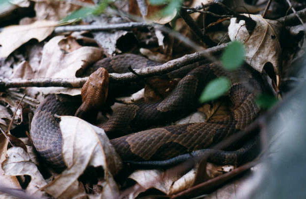
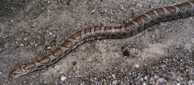
Copperhead @ Ohiopyle June 6 1997. On a rock ledge a Copperhead might be easy to spot, but when laying amidst leafy ground litter it takes a practiced eye to discern the Copperheads camouflaged form.
Copperhead @ Ohiopyle July 10 1996.
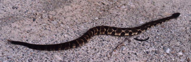
Eastern Milk Snake (40" long) on Rt381S on hill before Falling Water June 6 1997.
Eastern Milk Snake
Northern Water Snake, a young one, Loyalhanna Creek.
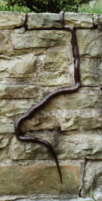
Black Rat Snake (5 feet long) caught at night in parking lot of the A-Plus Mini Mart on Lloyd Avenue in Latrobe July 1996. In this pic the snake is climbing a vertical stone wall alongside our driveway.
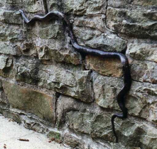
Black Rat Snake another sample of the Black Rat Snake's predisposition & skill at climbing.
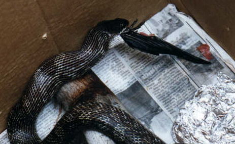
Black Rat Snake enjoying a meal of a fresh roadkill Grackle.
Black Rat Snake with blue eyes before shedding skin.
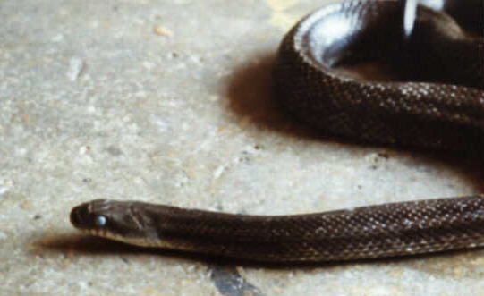
Black Rat Snake young one.
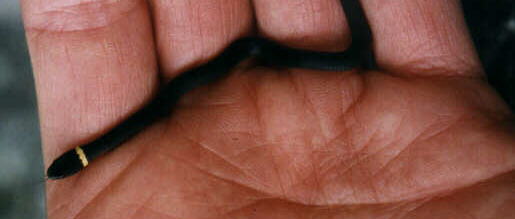
Ringneck Snake, young in hand.
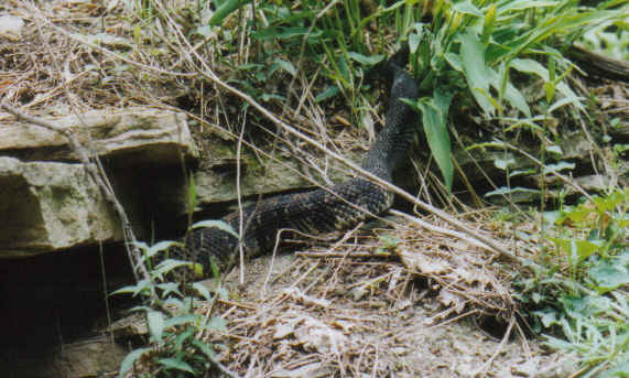
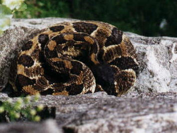
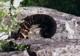
Timber Rattlesnake, dark variation, July 1998. This Rattler was beside my car when I returned from a hike.
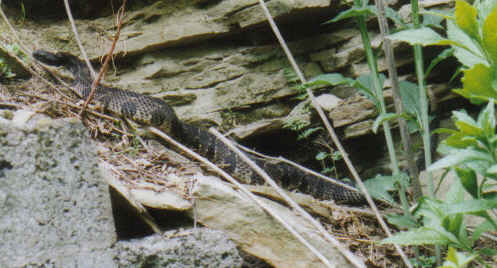
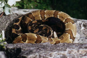
Timber Rattlesnake
Timber Rattlesnake coiled, rattling, & ready to strike. The rattling sounds more like the buzzing of a cicada.
Two Timber Rattlesnakes, yellow & dark variations, August 8 1995. The two rattlers are intercoiled, their heads situated side by side, though the black head of the dark snake to the left is difficult to discern in the scanned image (the original photo is better). The images are in sequence as the snakes moved beneath the ledge I was on. They began to rattle in response to my presence as I leaned over the top of a cliff to take these photos:
Rattlesnakes 1 |
Rattlesnakes 2 |
Rattlesnakes 3 |
Rattlesnakes 4
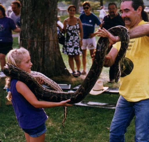
Burmese Python & girl, Snake Show @ Ohiopyle July 22 1995. The young girl was entranced by the big snake, much to the aghast of some of the adults.
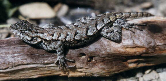
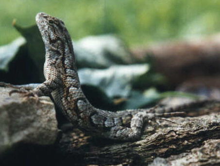
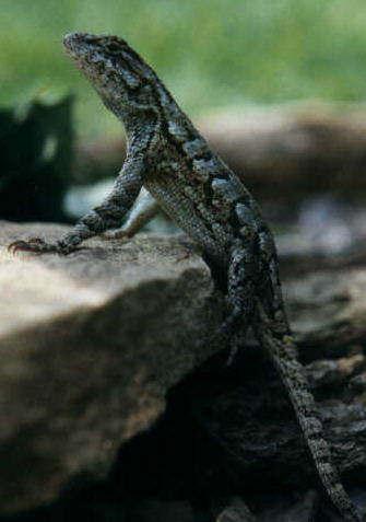
Fence Lizard, southwestern PA, August 1996. The Fence Lizard is the most common of the lizard species native to Pennsylvania.
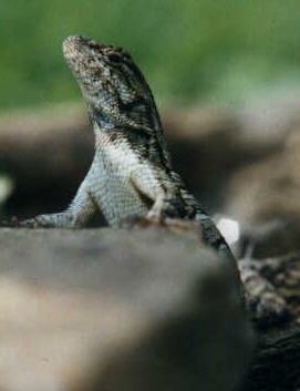
Fence Lizards are expressive: Fence Lizard | Fence Lizard | Fence Lizard |
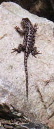
Fence Lizard
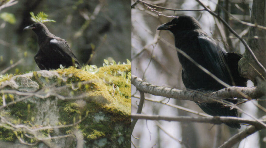
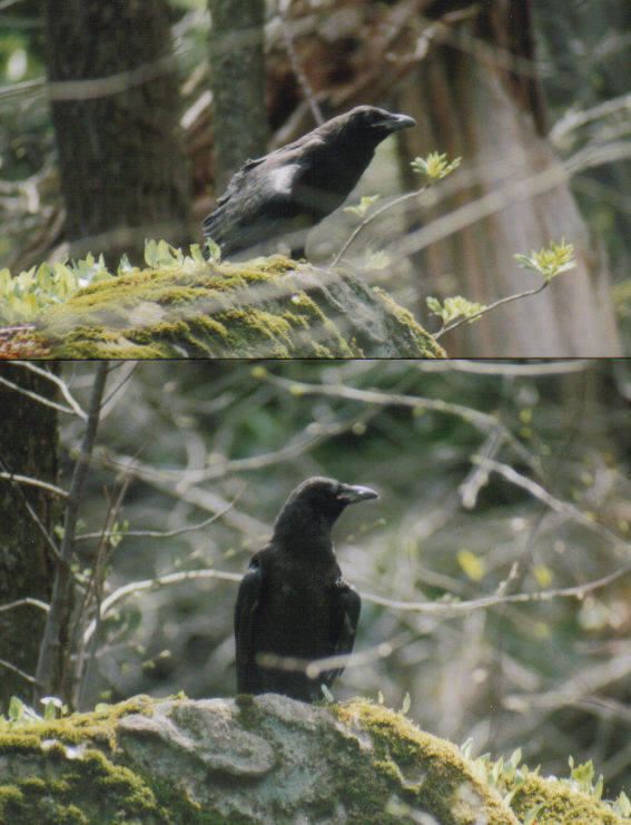
Young raven fledged from the nest, spring 2004: Raven | Raven
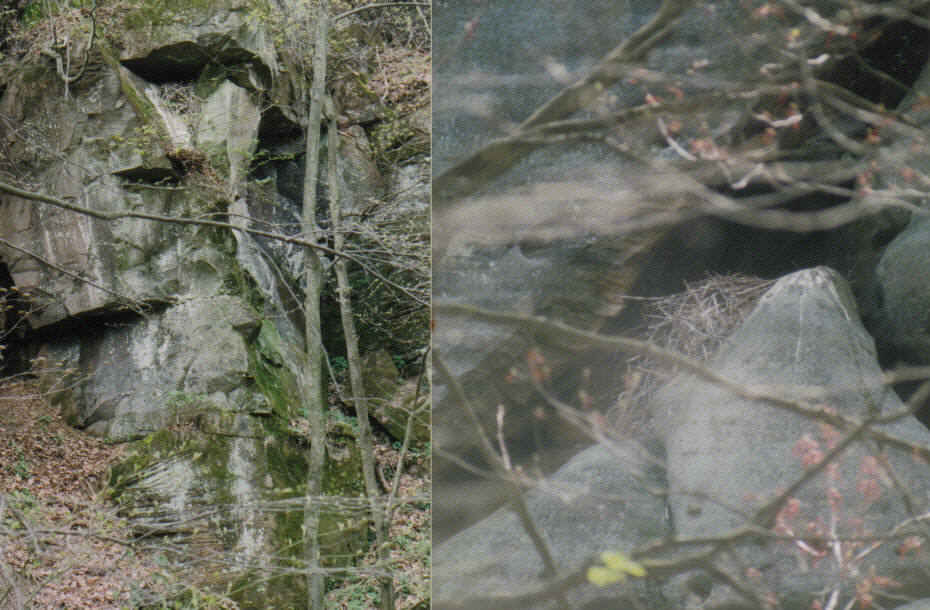
Two raven nests on Laurel Ridge. Nest on left is beneath shadowed ledge near top of pic: Raven nests
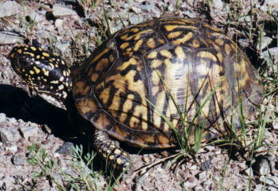
Box Turtle on Chestnut Ridge.
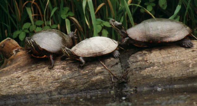
Painted Turtles @ Donegal Lake (photo from kayak).
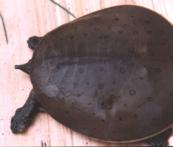
Spiny Soft Shell Turtle (male) from Loyalhanna Creek in Latrobe. This turtle was in rehab after having been hooked by a fisherman.
Spiny Soft Shell Turtle
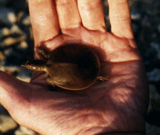
Baby Spiny Soft Shell Turtle from Loyalhanna Creek Bush Recreation Area beach.
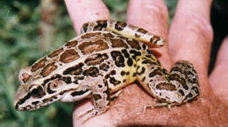
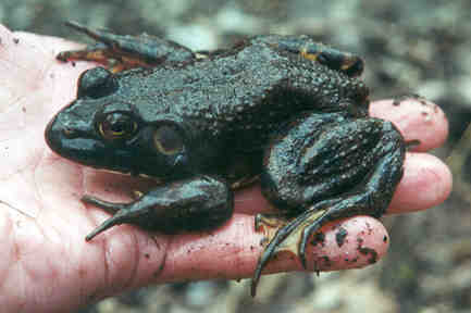
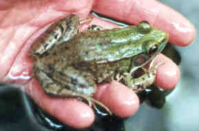
Pickerel Frog from Loyalhanna Lake.
Spring Peeper | Spring Peeper (a peeper can fit on a quarter)
Wood Frog | Wood Frog
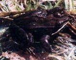
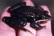
Bull Frog
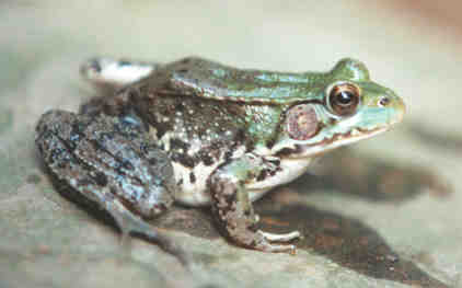
Green Frog | Green Frog
Lance-leaved Violet on the shoreline of Conemaugh River in Packsaddle Gap, Westmoreland County, June 7 2005.
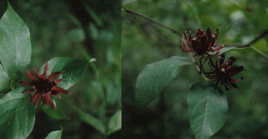
Allspice (Sweetbush) flowering in the Loyalhanna Gorge, June 2 2005.
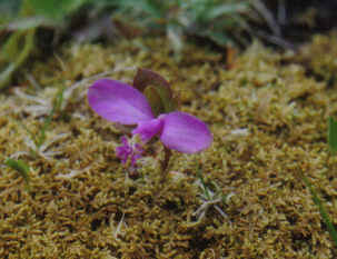
Gaywing on Laurel Summit, Linn Run Rd.
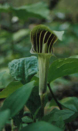
Jack-in-the-pulpit at Twin Lakes Co. Park 5/2005.
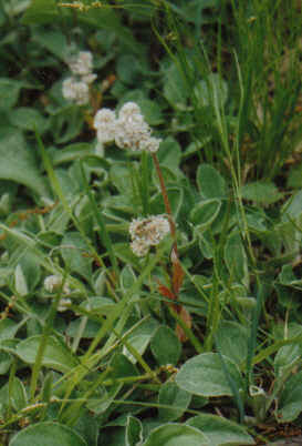
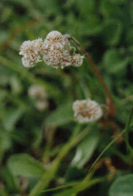
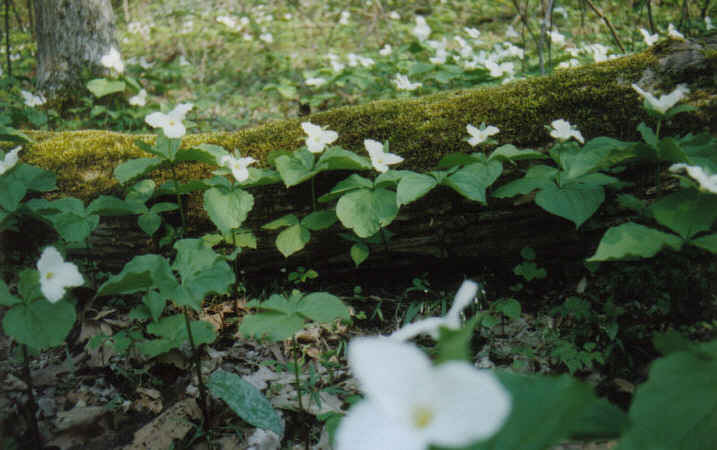
plants, moss, log at Nature Park behind Barnes & Noble Rt30 Greensburg.Pussytoes at Oaks Point Overlook, Packsaddle Gap, May 22 2005:
Pussytoes | Pussytoes
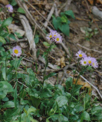
When I first saw these I thought they were asters blooming in a seasonal time-warp, at Oaks Point Overlook, Packsaddle Gap, May 22 2005: Robin-plantain
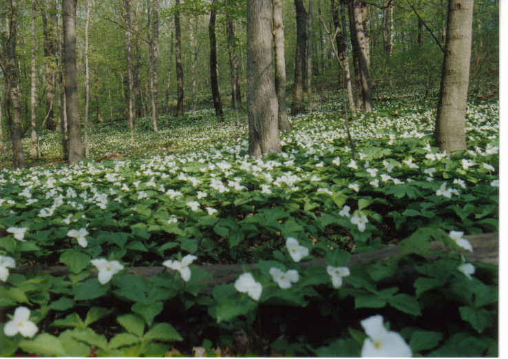
A sampling of the trillium display at Twin Lakes County Park, lower lake, May 2005:
Trillium | Trillium
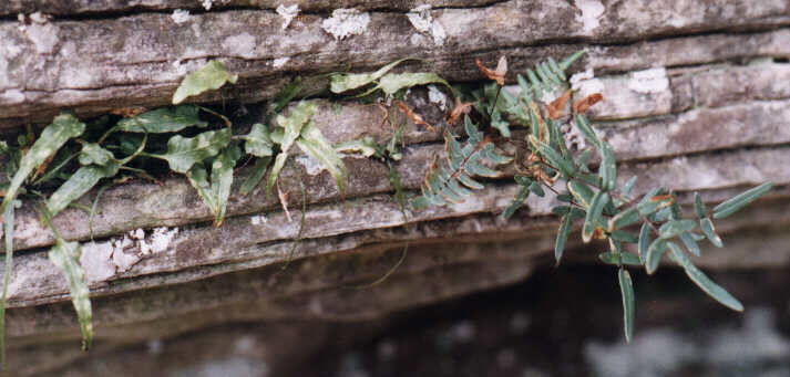
Walking Fern & Cliffbrake Fern, Chestnut Ridge. Both species are rare according to the Peterson Field Guide to Ferns. The Cliffbrake is either Purple Cliffbrake (Pellaea atropurpurea) or the variety Smooth Cliffbrake (Bushii, sometimes considered the species Pellaea glabella).
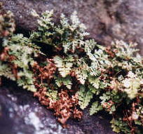
Mountain Spleenwort Fern, Chestnut Ridge
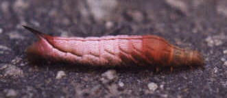
Caterpillar, a Sphinx Moth larva
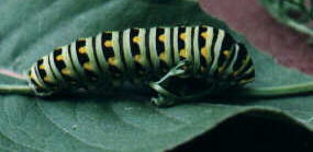
Caterpillar, Black Swallowtail.
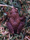
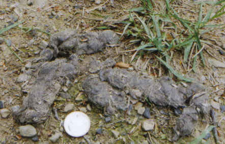
Old scat from coyote (w/quarter placed nearby for perspective). A rodent tooth is visible in the portion near top of photo, 2005:
Coyote scat
More scanned photographs are linked to Images #2 | Images #3 | Images #4
All of the above images linked to this page are scanned photos taken & owned by tim vechter, copyright ©1999.
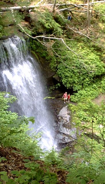
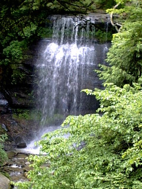
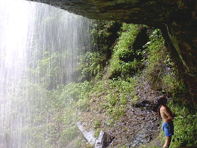
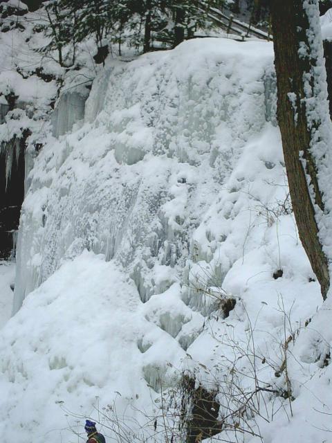
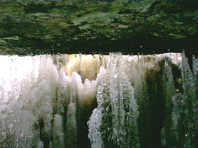
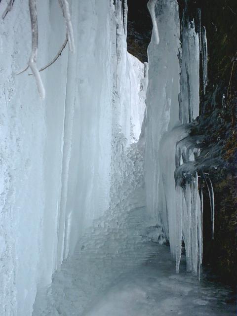
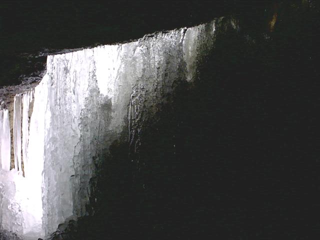
Photographs, taken by Kim Castle, of Buttermilk Falls, Indiana County, summer of 2003; view from observation deck | view from observation deck |
under falls
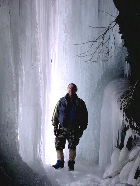
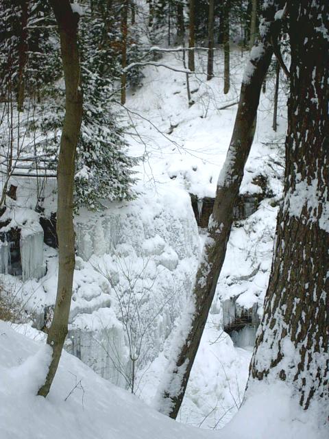
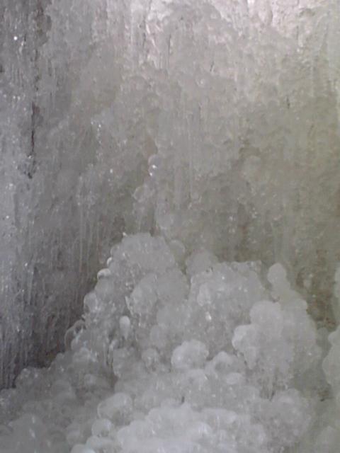
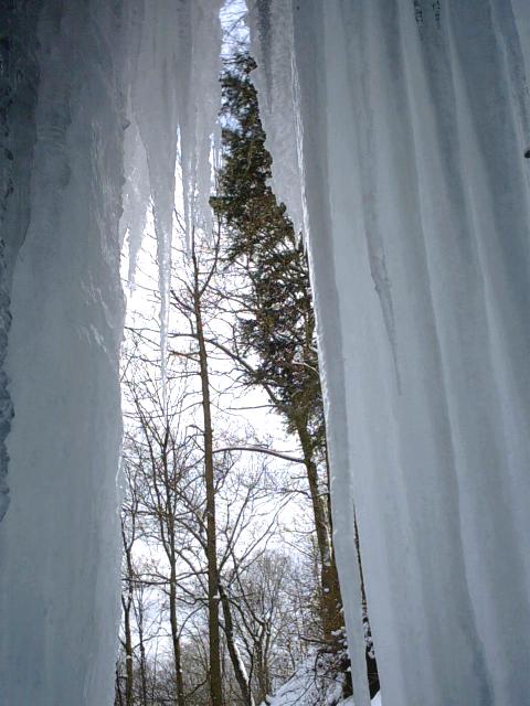
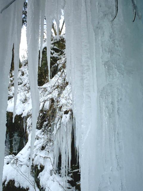
January 24 2004; behind falls |
behind falls |
behind falls |
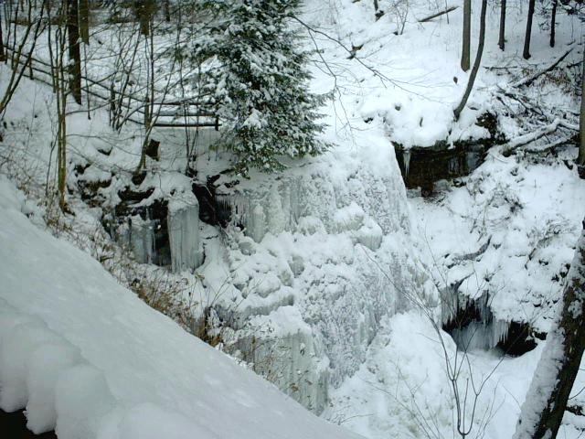
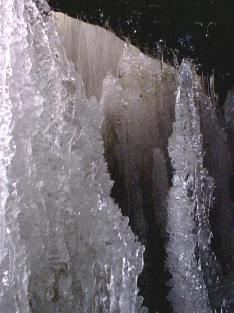
facing falls |
falls |
falls |
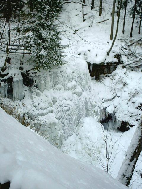
falls |
falls |
falls |
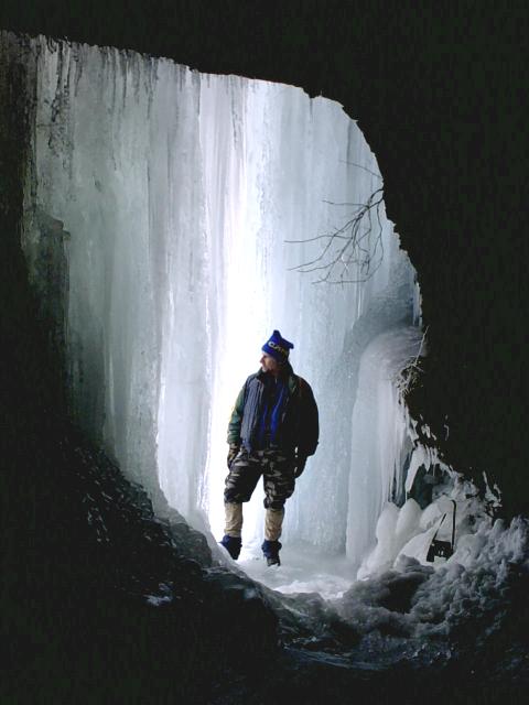
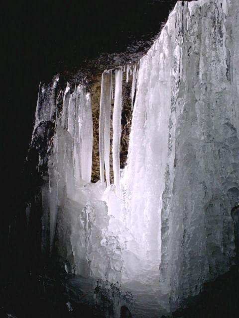
behind falls |
behind falls |
behind falls |
from behind falls |
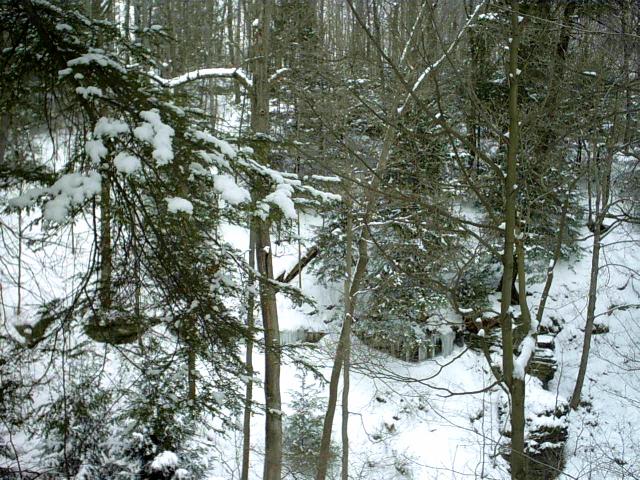
hillside nearby |
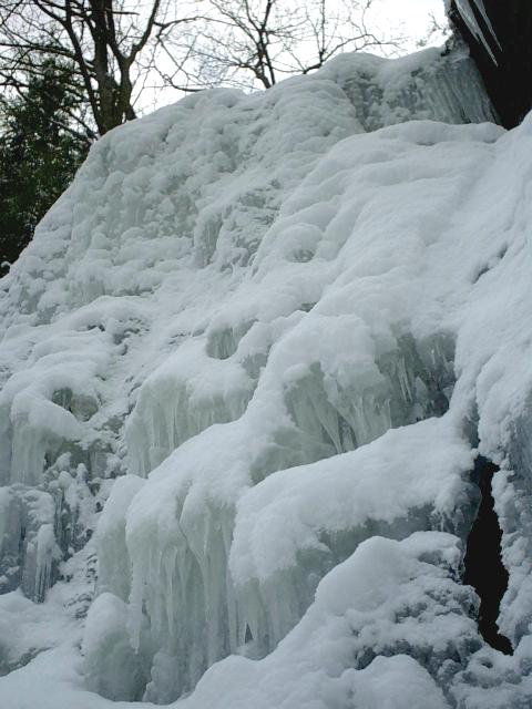
behind falls |
behind falls |
behind falls |
behind falls |
behind falls
Screaminghawk's links || Westmoreland County bird sightings || site map
|| Sign Guestbook
Top of Page
~ end of page ~